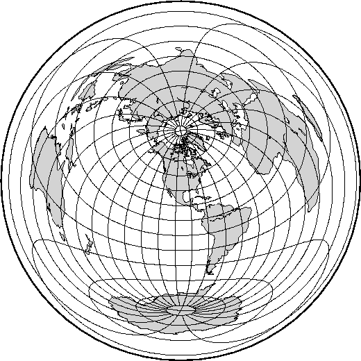
The most noticeable feature of this azimuthal projection is the fact that distances measured from the center are true. Therefore, a circle about the projection center defines the locus of points that are equally far away from the plot origin. Furthermore, directions from the center are also true. The projection, in the polar aspect, is at least several centuries old. It is a useful projection for a global view of locations at various or identical distance from a given point (the map center).
To specify the azimuthal equidistant projection you must supply:
Our example of a global view centered on 100![]() W/40
W/40![]() N
can therefore be generated by the following pscoast
command. Note that the antipodal point is 180
N
can therefore be generated by the following pscoast
command. Note that the antipodal point is 180![]() away from
the center, but in this projection this point plots as the
entire map perimeter:
away from
the center, but in this projection this point plots as the
entire map perimeter:
pscoast -Rg -JE-100/40/4.5i -B15g15 -Dc -A10000 -Glightgray -W0.25p -P > GMT_az_equidistant.ps