The equidistant conic projection was described by the Greek philosopher Claudius Ptolemy about A.D. 150. It is neither conformal or equal-area, but serves as a compromise between them. The scale is true along all meridians and the standard parallels. To select this projection in GMT you must provide the same information as for the other conic projection, i.e.
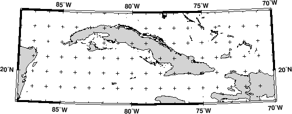
The equidistant conic projection is often used for atlases with maps of small countries. As an example, we generate a map of Cuba:
gmtset PLOT_DEGREE_FORMAT ddd:mm:ssF GRID_CROSS_SIZE_PRIMARY 0.05i
pscoast -R-88/-70/18/24 -JD-79/21/19/23/4.5i -B5g1 -Di -N1/1p -Glightgray \
   -W0.25p -P > GMT_equidistant_conic.ps
gmtset GRID_CROSS_SIZE_PRIMARY 0