The relentless zooming continues! Now, the edges of the map
are all 100 km true distance from the projection center. We
step up to the high resolution data set as it is needed to
accurately portray the detailed geographic features within the
region. Because of the small scale we only ignore features less
than 1 km![]() in area. The high resolution database has undergone
minor decimation and simplification by the DP-routine: The
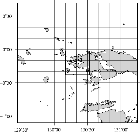
combined file size of the coastlines, rivers, and borders now
swells to 12.2 Mbytes. The map and the final outline box are
generated by these commands:
in area. The high resolution database has undergone
minor decimation and simplification by the DP-routine: The
combined file size of the coastlines, rivers, and borders now
swells to 12.2 Mbytes. The map and the final outline box are
generated by these commands:
pscoast `./getbox -JE130.35/-0.2/1i -100 100 -100 100` -JE130.35/-0.2/3.5i -P -Dh -A1 -Glightgray \
   -W0.25p -N1/0.25tap -B30mg10mWSne -K > GMT_App_K_4.ps
./getrect -JE130.35/-0.2/1i -20 20 -20 20 | psxy -R -JE130.35/-0.2/3.5i -O -W1.5p -L -A \
   >> GMT_App_K_4.ps