Next: 6.2.2.2 Rectangular Stereographic Map
Up: 6.2.2 Stereographic Equal-Angle Projection
Previous: 6.2.2 Stereographic Equal-Angle Projection
Contents
Index
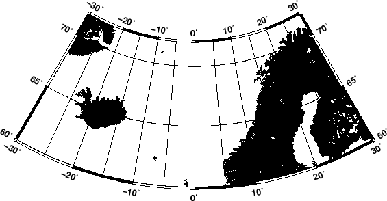
6.2.2.1 Polar Stereographic Map
In our first example we will let the projection center be at
the north pole. This means we have a polar stereographic
projection and the map boundaries will coincide with lines
of constant longitude and latitude. An example is given by
gmtset PLOT_DEGREE_FORMAT ddd:mm:ss
pscoast -R-30/30/60/72 -Js0/90/4.5i/60 -Ba10g5/5g5 -Dl -A250 -Gblack -P > GMT_stereographic_polar.ps
Figure 6.7:
Polar
stereographic conformal projection.
|
|
Next: 6.2.2.2 Rectangular Stereographic Map
Up: 6.2.2 Stereographic Equal-Angle Projection
Previous: 6.2.2 Stereographic Equal-Angle Projection
Contents
Index
Paul Wessel
2006-05-31